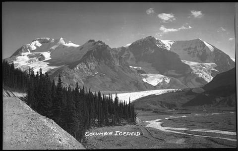
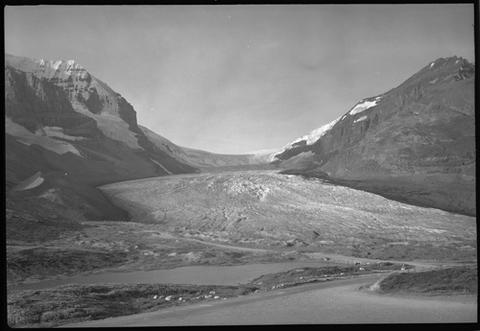
High in the heart of the Canadian Rockies, straddling the spine of the Continental Divide, lies the Columbia Icefield, a vast, windswept plateau of ice that has shaped both the land and the stories of those who sought it out. Formed during ancient glaciations hundreds of thousands of years ago, it is a remnant of a much colder world.
For centuries, the icefield remained hidden from European eyes. Indigenous peoples knew these mountains intimately, but for early outsiders, the region was remote, rugged, and difficult to reach. There were no roads, only narrow passes, river valleys, and long-established fur trade routes cutting through the wilderness. One of the closest of these was Athabasca Pass, a vital corridor used by traders.
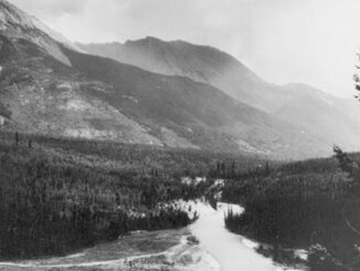
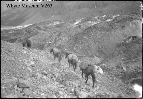
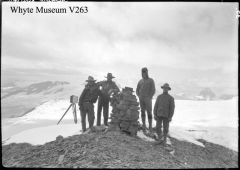
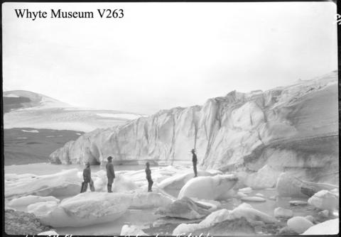
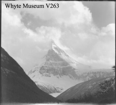
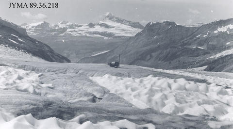
By the late 1800s, small expeditions, often outfitted from the growing mountain town of Banff, set out on horseback and on foot, pushing deeper into the Canadian Rockies. In 1898, British explorer J. Norman Collie and his companions made a breakthrough. After days of travel over rough terrain and unstable rock, they climbed onto a high ridge near Mount Athabasca and suddenly, the horizon opened. Before them stretched an ocean of ice, flowing outward in every direction. It was one of the last major natural features in western Canada to be documented by Europeans.
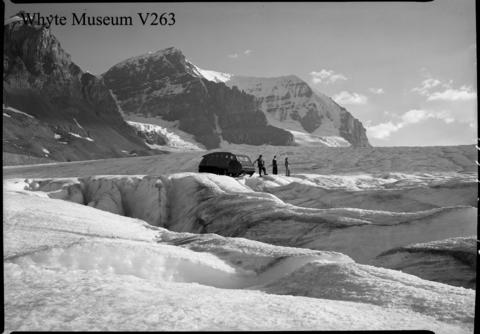
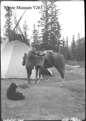
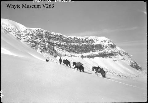
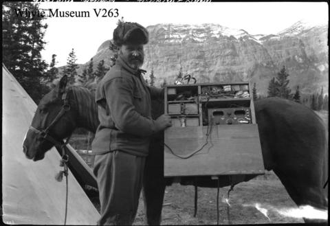
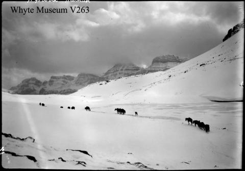
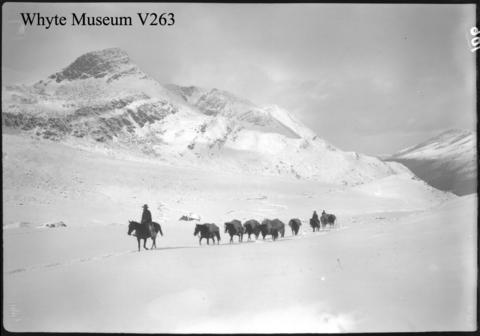
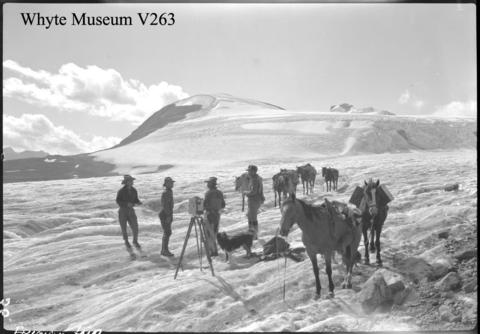
Reaching the icefield in those early years was no small feat. Expeditions carried heavy gear, relied on packhorses where possible, and then continued on foot across glaciers riddled with crevasses. Weather could change in minutes, and maps were often incomplete or nonexistent. Yet the challenge only added to the allure. By the early 1900s, mountaineers like James Outram and later international climbing teams were making first ascents of the towering peaks surrounding the icefield, slowly revealing its scale and complexity.
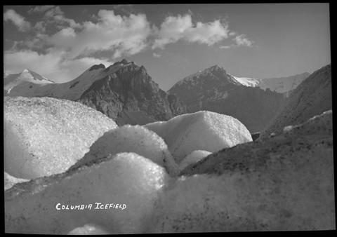
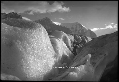
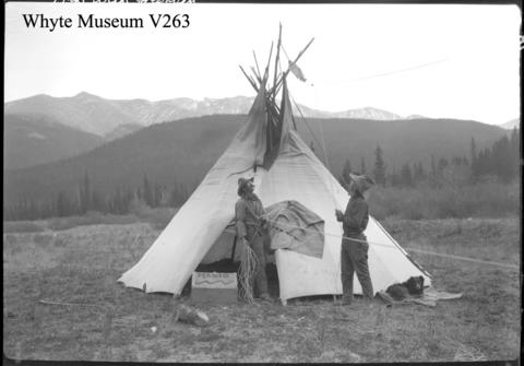
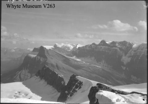
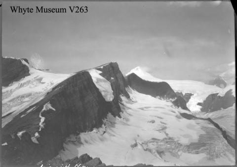
Photographs from this era capture more than just ice, they tell stories of endurance, curiosity, and discovery. Figures stand small against sweeping glaciers, roped together as they cross frozen expanses that seemed endless. These early journeys helped transform the Columbia Icefield from a remote mystery into a place of wonder, drawing scientists, climbers, and adventurers from around the world.
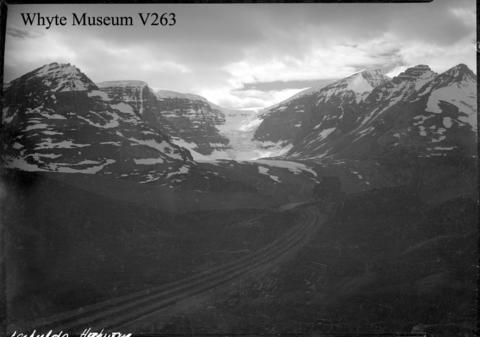
Today, the icefield is far more accessible, reached by the Icefields Parkway. Yet those early images remind us of a time when getting there meant days or weeks of travel through untamed wilderness, when the first sight of that vast white horizon must have felt like discovering another world.
For even more stories about snow and ice, please see my previous posts, including: Wild Jobs: Glacier Monitoring, Wild Jobs: Glacier Guide, Historic Photos of Glaciers from the Canadian Rockies, Old Photos of Glaciers from Western Canada: Part 2, and Touch Ice, Take Action with Glacier Hikes and Adventures.
The photos above were collected from Archives Canada. For more information, you can find additional details about each photograph on their website. Stay tuned for additional posts featuring historical photos from across Alberta and Western Canada. We’d love to know what you think in the comment section below.