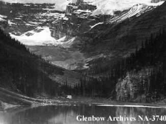
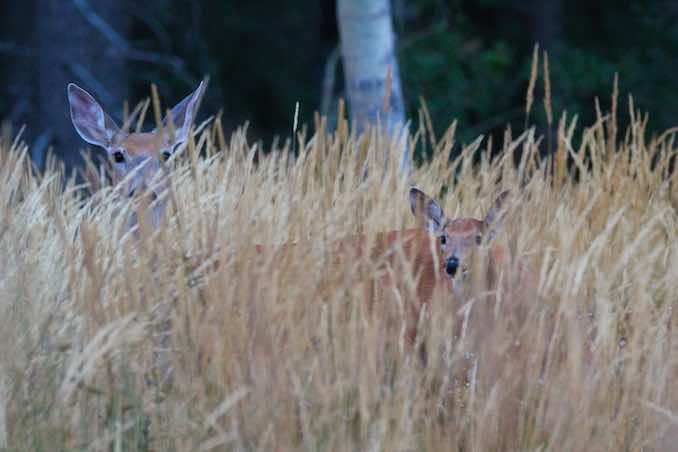
The Cypress Hills rise 600 metres above the surrounding prairies making it the highest point between the Canadian Rockies and the Labrador Peninsula on the east coast. The unique mix of climate, geography, and ecosystems create a home for an extensive diversity of plants and animals. Eighteen species of orchid have been recorded in the area; more than anywhere else on the prairies. There are also over 220 species of bird, 47 different mammals, and several species of both reptile and amphibian that call the Cypress Hills home.
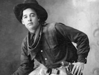
In 1869 the Hudson’s Bay Company transferred Rupert’s Land to the Canadian Government, but it would still be a number of years before law and order could be brought to the western territory. In the early 1870’s the entire region was a tinderbox. Ungoverned trading posts and whiskey forts, dispirited First Nation groups, and wolf hunters all contributed to this volatile scene. On June 1, 1873 everything came to a head when a trader discovered his horse had been stolen. He immediately, but falsely, accused a group of Nakoda camped nearby. After recruiting several wolf hunters and Métis they attacked the camp. By the end of the day more than 20 Nakoda were dead and the Cypress Hills Massacre was born. As a direct result of this tragedy the newly formed North West Mounted Police (now the Royal Canadian Mounted Police) headed west to bring order to Canada’s newest territory. Fort Walsh was established in 1875 and became the largest and most heavily armed fort in the NWMP’s possession. In a mere seven years the NWMP abolished the whiskey trade and brought law and order to western Canada.
By 1882 the bison and Grizzly Bear were extirpated from Cypress Hills while populations of other game animals were severely depleted. These drastic declines completely changed the way of life on the prairies. The Canadian Pacific Railway was quickly making it’s way through the west and with it came settlers, ranchers, and farmers, setting the stage for a rapid transformation the prairies had never seen. The earliest tourists to the Elkwater area can be dated back to 1907, with the first cottage being constructed in 1913. The park was first established in 1931 on the Saskatchewan side and was expanded into Alberta in 1951, making it Canada’s first Interprovincial Park. Today the park is divided into three sections; the Alberta side around Elkwater, the West Block Wilderness Area, and the Centre Block, both of which are on the Saskatchewan side of the border.
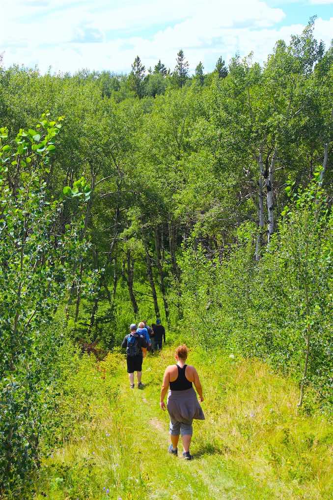
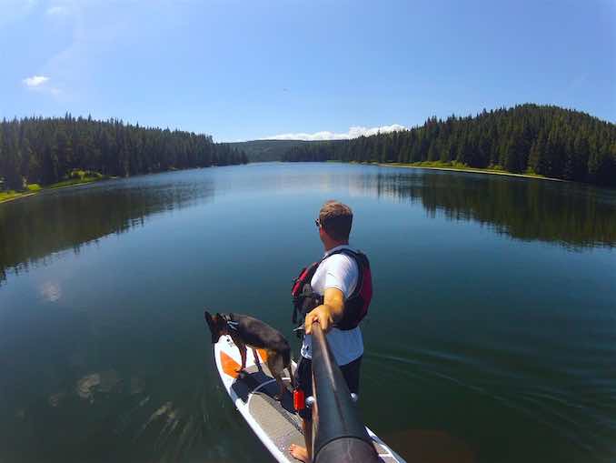
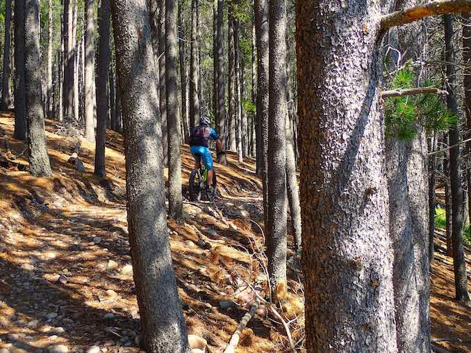
Today the park offers incredible outdoor recreation opportunities, such as hiking, horseback riding, mountain biking, boating, paddle sports, and camping, as well as playgrounds for children, a disc golf course, scenic driving tours, wildlife viewing, historical sites, a visitor centre, and so much more. And those are just the possibilities during the summer months; winter opens up new prospects like cross-country skiing, snowshoeing, and even downhill skiing and snowboarding at Hidden Valley Resort. There really is something for the whole family to enjoy.
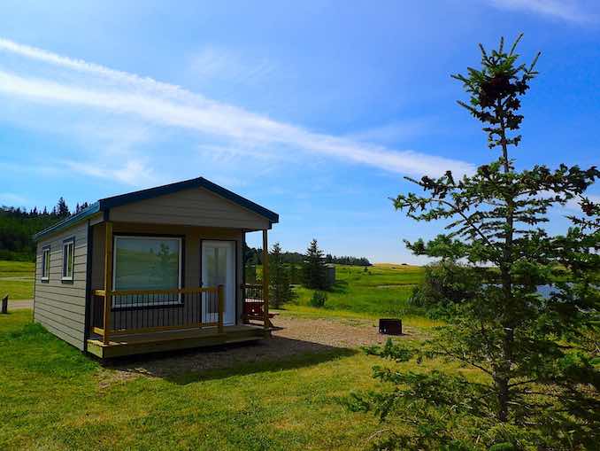
A group of us have camped there the past three summers and haven’t duplicated any of the attractions yet. Due to its popularity I recommend reserving a spot early to ensure you get that perfect campsite. The Firerock Campground is a personal favourite. The sites are spacious and private and are a short drive or bike ride down to the lake and visitor centre. If tents and trailers aren’t your thing you could also look at some of the comfort camping options as provided by Alberta Parks. I spent a couple of nights in a lakeside Firerock Cabin and it was a fantastic alternative to more traditional styles of camping.
If you’d like more information about the Cypress Hills area please visit the websites for Alberta Parks, Saskatchewan Parks, and the Cypress Hills Destination Area. The TrailForks website is a reliable resource for trail maps and information, especially if you plan to explore the park on two wheels. I used it for both biking and hiking while in the park and it worked great. Make sure you download the app, available for both Android and Apple, so you’ll have all the maps at your fingertips no matter where you are. For more information about the best kept mountain biking secret in the province please read this story, Mud, Sweat and Gears, I wrote for Seekers Media. Lastly, the 670 Collective is a local mountain bike club based out of Medicine Hat. They’re responsible for building and maintaining all the incredible new trails in the Elkwater area. They’re a friendly, outgoing bunch that love to ride, so connect with them if you’re looking for some local favourites.